Synthetic Vision and Virtual Navigation
Written on Friday, October 13, 2006 by Gemini
AVIATION DEATHS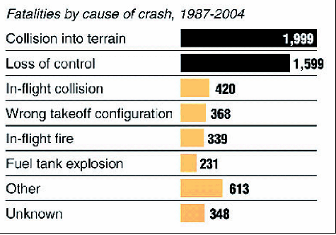
Colliding into terrain and loss of control are the leading causes of aeroplane fatalities worldwide since 1987, making up nearly two-thirds of all deaths*
* Includes passengers, crew and fatalities on the ground; Does not include deaths from the Sep. 11 attacks
CREATING A COMPLETE SYSTEM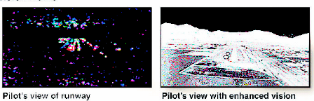
Because of concerns about potential inaccuracies in the topographic database, the FAA has called for a system that incorporates synthetic vision and enhanced vision, a technology already in use.
How Enhanced Vision Works:
The system uses infrared sensors to create images on a display that the human eye cannot see
VIRTUAL NAVIGATION
A technology called synthetic vision will assist pilots by offering a crisp, video-game-like view of the terrain below in low-visibility conditions.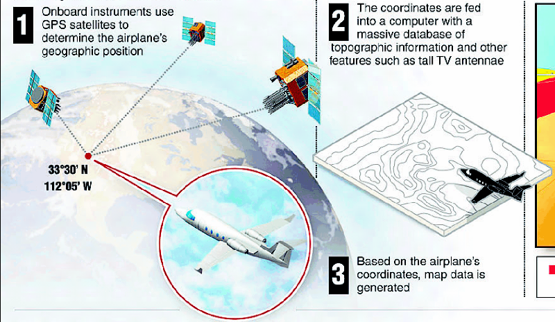
How Synthetic Vision Works:
1. Onboard instruments use GPS satellites to determine the airplane's geographic position
2. The coordinates are fed into a computer with a massive database of topographic information and other features such as tall TV antennae
3. Based on the airplane's coordinates, map data is generated
4. The data are converted into three-dimensional graphics and positioned to give the pilot a view of the terrain; graphics are constantly updated as the plane's coordinates change
![]()

